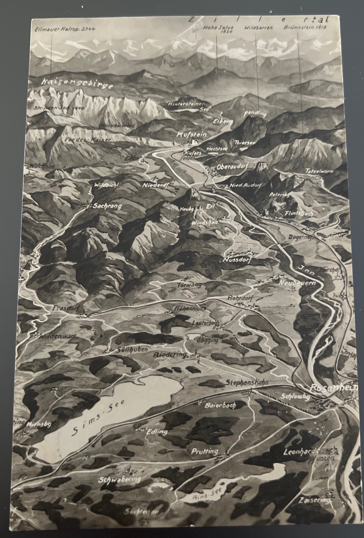
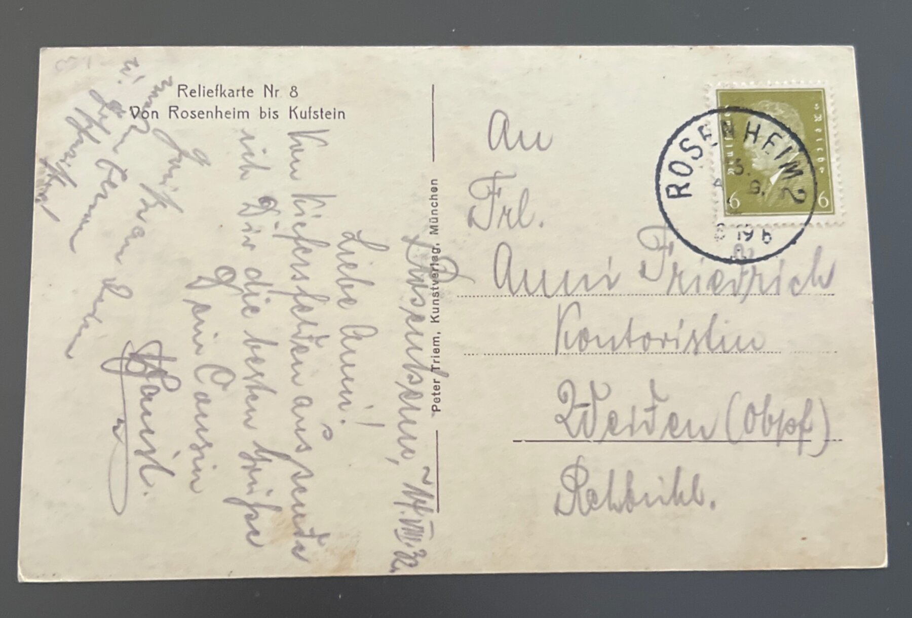
Postcard 1930s Zillertal Bavaria Relief Map Rosenheim Kufstein Germany
An extraordinary aerial-perspective relief map postcard captures the sweeping Zillertal corridor from Rosenheim northward to Kufstein and the dramatic Kaisergebirge peaks — Ellmauer Halt at 2344m, Hohe Salve, Wildbarren, and Brünnstein all labeled with their elevations — rendered as a richly shaded painterly panorama that makes the Alps feel touchable. This "Reliefkarte Nr. 8" from publisher Peter Triem of Munich was part of a numbered series depicting Bavarian Alpine districts in this distinctive bird's-eye cartographic style, popular with tourists and hikers in the Weimar and early Nazi eras. Sent from Rosenheim in September 1931 by a writer who signs off warmly — addressed to "liebe Anna" (dear Anna), a Kontoristin (office clerk) in Westen, Ostholstein — a small piece of inter-regional German correspondence, mountain sender to North Sea coast recipient.